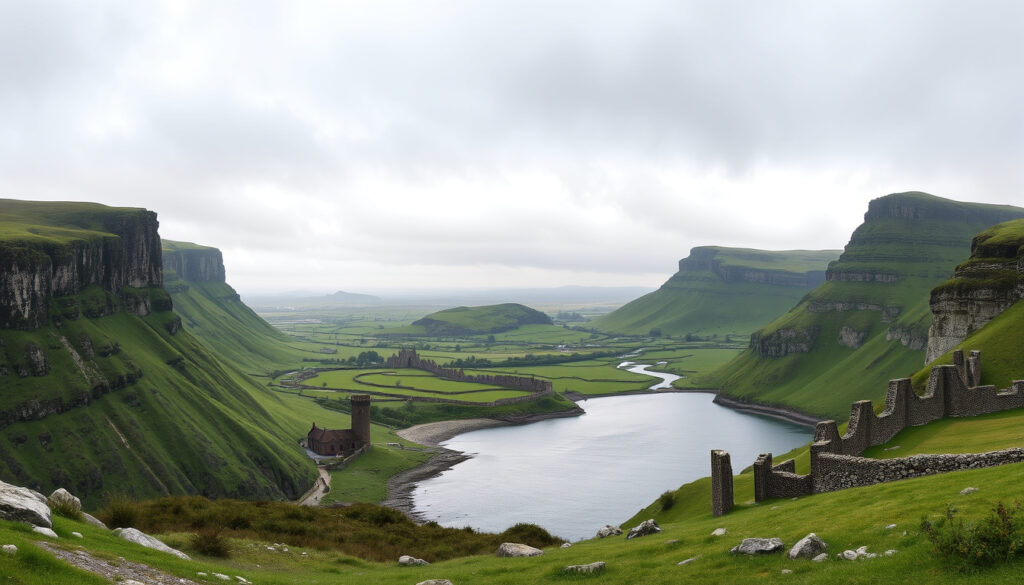
4 Provinces of Ireland: Connacht, Leinster, Munster, and Ulster
There’s a reason the Irish greet each other by asking, “What county are you from?”—the answer often reveals a whole world of identity, rivalry, and pride. The four provinces of Ireland—Connacht, Leinster, Munster, and Ulster—aren’t just lines on a map; they’re echoes of ancient kingdoms that still shape local culture today.
Provinces of Ireland: 4 ·
Counties in total: 32 ·
Original kingdoms: 4 ·
Provinces in Republic of Ireland: 3 (Connacht, Leinster, Munster) ·
Province partly in Northern Ireland: Ulster ·
Largest province by population: Leinster
Quick snapshot
- Counties: Galway, Leitrim, Mayo, Roscommon, Sligo (Ireland.com – official tourism authority)
- West region (Ireland.com – official tourism authority)
- Known for Connacht Rugby (IrishCentral – Irish diaspora media)
- Counties: Carlow, Dublin, Kildare, Kilkenny, Laois, Longford, Louth, Meath, Offaly, Westmeath, Wexford, Wicklow (Ireland.com – official tourism authority)
- East region (IrishCentral – Irish diaspora media)
- Most populous province (Ireland.com – official tourism authority)
- Counties: Clare, Cork, Kerry, Limerick, Tipperary, Waterford (Ireland.com – official tourism authority)
- South region (IrishCentral – Irish diaspora media)
- Known for Ring of Kerry (Ireland.com – official tourism authority)
- Counties: Antrim, Armagh, Cavan, Derry, Donegal, Down, Fermanagh, Monaghan, Tyrone (Ireland.com – official tourism authority)
- North region (IrishCentral – Irish diaspora media)
- Part in Republic (Cavan, Donegal, Monaghan) and part in Northern Ireland (Wesley Johnston – educational geography site)
Five key numbers sum up the geography of Ireland’s four provinces.
| Label | Value |
|---|---|
| Total provinces | 4 |
| Total counties | 32 (Ireland.com – official tourism authority) |
| Provinces in Republic of Ireland | 3 (Connacht, Leinster, Munster) |
| Province partly in Northern Ireland | Ulster (IrishCentral – Irish diaspora media) |
| National animal | Irish hare (Wikipedia – encyclopedia resource) |
What are the 4 original provinces of Ireland?
The four ancient kingdoms: Connacht, Leinster, Munster, Ulster
The four provinces correspond to the four major kingdoms that existed on the island around the 2nd century AD: Connacht (west), Leinster (east), Munster (south), and Ulster (north). A fifth kingdom, Mide (meaning “middle”), once existed but was later absorbed, leaving the four that survived as cultural and sporting divisions (Ordnance Survey Ireland – national mapping agency open data).
How the provinces map to modern counties
Every county belongs to exactly one province. The breakdown by province is clear:
- Connacht: 5 counties (Galway, Leitrim, Mayo, Roscommon, Sligo) (Ireland.com – official tourism authority)
- Leinster: 12 counties (Ireland.com – official tourism authority)
- Munster: 6 counties (Ireland.com – official tourism authority)
- Ulster: 9 counties (Ireland.com – official tourism authority)
The catch: Ulster is the only province split by the border—three of its counties (Cavan, Donegal, Monaghan) are in the Republic, while six (Antrim, Armagh, Derry, Down, Fermanagh, Tyrone) are in Northern Ireland (Wesley Johnston – educational geography site).
Why does Ireland have four provinces?
Historical origins as four independent kingdoms
The division into four provinces dates back to the medieval period, when Ireland was a patchwork of independent tuatha (tribal kingdoms). Over time, political consolidation reduced the number of major kingdoms to four, each with its own king and assembly. The Norman invasion of the 12th century reorganized territories, but the provincial boundaries survived as cultural markers rather than administrative lines.
Evolution from kingdoms to modern administrative regions
Today, the provinces have no legal administrative function. Local government is managed by county and city councils. However, the four provinces remain active in sporting identity—Gaelic games (GAA) are organized by province, and rugby’s provincial teams (Connacht, Leinster, Munster, Ulster) compete at the professional level. They are also used in cultural events and tourism promotion (IrishCentral – Irish diaspora media).
What does 32 mean in Ireland?
The 32 counties of Ireland across all provinces
The number 32 is shorthand for the entire island of Ireland, representing all counties from Donegal in the north to Cork in the south. The county map remains a standard educational tool, showing 26 counties in the Republic of Ireland and 6 in Northern Ireland (Wesley Johnston – educational geography site).
How counties are grouped within each province
Each province contains a specific number of counties. Leinster, with 12, is the largest by county count; Connacht, with 5, is the smallest. This grouping is frequently used in educational maps and tourism literature (Twinkl – educational resource provider).
The implication: when you hear “the 32 counties,” you’re hearing a reference to the full geographic scope of the island—a number that carries historic weight in everything from sporting anthems to political discourse.
What is the Irish animal?
The Irish hare as the national animal
Ireland’s national animal is the Irish hare (Lepus timidus hibernicus), also called the mountain hare. It is a subspecies distinct from the European hare, found only on the island of Ireland (Wikipedia – encyclopedia resource).
Other iconic Irish wildlife
While the hare holds the official title, other animals are strongly associated with Ireland: the red deer (the only native deer species), the corncrake (a bird known for its distinctive call), and the Irish wolfhound (a historic breed once used for hunting wolves). Each province also has its own symbolic animal in folklore.
What is considered impolite in Ireland?
Irish pub etiquette and what not to order
Visitors to an Irish pub are generally welcome, but a few rules help avoid awkwardness. Don’t order a “full Irish” breakfast at a pub that serves only snacks in the evening. And never, under any circumstances, ask for an “Irish car bomb” cocktail—the name is deeply offensive. Stick to a pint of stout or a whiskey.
Conversation taboos and local customs
Interrupting someone mid-sentence is considered rude; the Irish value conversational flow. Talking loudly or boasting is frowned upon. Personal space is respected, though pub environments can be lively. Avoid bringing up the Troubles or partition unless you know the company well.
Visitors who follow pub etiquette get a warmer welcome and better conversation. Those who don’t risk being politely ignored—or politely corrected.
Four provinces, one pattern: each differs in county count, location, and cultural flavor.
| Province | Counties | Location | Known for |
|---|---|---|---|
| Connacht | 5 (Ireland.com – official tourism authority) | West (IrishCentral – Irish diaspora media) | Connacht Rugby, wild Atlantic coast |
| Leinster | 12 (Ireland.com – official tourism authority) | East (IrishCentral – Irish diaspora media) | Dublin city, historic sites |
| Munster | 6 (Ireland.com – official tourism authority) | South (IrishCentral – Irish diaspora media) | Ring of Kerry, Blarney Castle |
| Ulster | 9 (Ireland.com – official tourism authority) | North (IrishCentral – Irish diaspora media) | Giant’s Causeway, split border |
Timeline: The four provinces through history
- c. 2nd century AD: The four ancient kingdoms are documented; a fifth province (Mide) falls away (Wikipedia – encyclopedia resource).
- 12th century: Norman invasion reorganizes territories, but provinces remain cultural divisions.
- 1921: Partition creates Northern Ireland; Ulster province is split between two jurisdictions (Wesley Johnston – educational geography site).
- Current: Provinces have no administrative role but are used for rugby, GAA, and cultural identity (Ordnance Survey Ireland – national mapping agency open data).
What we know and what’s still debated
Confirmed facts
- Four provinces: Connacht, Leinster, Munster, Ulster (Ireland.com – official tourism authority)
- 32 counties total (Ireland.com – official tourism authority)
- National animal is the Irish hare (Wikipedia – encyclopedia resource)
- Ulster contains counties in both the Republic and Northern Ireland (Wesley Johnston – educational geography site)
What’s unclear
- Exact number of “original” kingdoms before consolidation (reported from medieval manuscripts)
- Precise origin of the province names (some sources suggest older Celtic roots, others Norman influence)
What the sources say
“The provinces of Ireland have no administrative function but are important for cultural and sporting identity.”— Wikipedia – encyclopedia resource
“Ireland’s four provinces—Ulster, Munster, Connacht, and Leinster—each have their own distinct character and traditions.”— IrishCentral – Irish diaspora media
“The Irish hare is found only in Ireland and is considered the national animal.”— Wikipedia – encyclopedia resource
For anyone planning a trip to Ireland, the four provinces offer more than just a map—they offer a way to explore different landscapes, accents, and histories. If you start in Leinster with a visit to Dublin, the province’s capital, you’ll find a vibrant city full of history. Want to explore the rugged coast? Head to What to See in Dublin for a solid itinerary. Further south, Munster’s County Kerry is famous for the Ring of Kerry and unpredictable weather—check Weather in County Kerry 10 Days: Storm & Snow 2026 before you go. Each province deserves its own chapter; understanding their boundaries and meaning makes the trip richer.
facebook.com, ezilon.com, drupal.org, bogandthunder.com, en.wikipedia.org, tiktok.com
For a deeper dive into the linguistic heritage, explore the Irish names of all 32 counties with their pronunciations and meanings.
Frequently asked questions
Are the four provinces official administrative divisions?
No. According to Ordnance Survey Ireland – national mapping agency open data, the provinces currently have no administrative function.
Which province is Dublin in?
Dublin is in the province of Leinster (Ireland.com – official tourism authority).
How many counties are in each province?
Connacht: 5, Leinster: 12, Munster: 6, Ulster: 9 (Ireland.com – official tourism authority).
What is the difference between a province and a county?
A province is a grouping of several counties. Counties are the primary local government divisions. There are 32 counties and 4 provinces on the island of Ireland.
Can you visit all four provinces in one trip?
Yes, but it requires a good itinerary. The island is small enough that you can drive from Connacht to Ulster in a few hours. Popular road trips often include stops in Galway (Connacht), Dublin (Leinster), Cork (Munster), and Belfast (Ulster).
Do the provinces have their own flags?
Yes, each province has a traditional flag: Connacht (white and blue with an eagle and a black eagle), Leinster (green with a gold harp), Munster (blue with three gold crowns), Ulster (red hand on a white and yellow shield). These are often used in sports and cultural events.
Why is Ulster sometimes considered separate from Northern Ireland?
Ulster is a historic province that includes counties in both the Republic (Cavan, Donegal, Monaghan) and Northern Ireland (the other six). Northern Ireland is a political entity covering part of Ulster, but the province itself extends across the border.
More related posts
 Best Exercises for Flexibility at Home: Stretches for Seniors
 Dependent Relative Tax Credit: Eligibility & Amount 2025
 VFS Ireland Visa Tracking – Status Guide and Timelines
 Houses to Rent in Dundalk: Complete Guide & Listings (2025)
 Fast and Furious 9: Hit, Flop, or Somewhere In Between
 How to Fix Phone Speaker: Troubleshooting Guide (2025)
 Time in Washington DC Now: EST/EDT Time Zone Guide
 Barry Keoghan & Sabrina Carpenter Split: Facts and Timeline